Hong Kong case studies: Part 1
The following case studies are a glimpse of I've done in geography fieldtrips. Here's also a chance to know a bit more about Hong Kong.
1. Chung Hom Kok Beach
Location: South of Hong Kong Island, Hong Kong
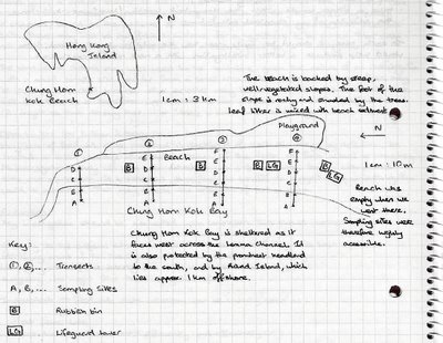
This is a small 150 m, public beach in a rich (suburban) district. When we went there, it was deserted (probably because it was a weekday), and the weather was really bad. But it was peaceful.
We went there to investigate whether longshore drift occurs on this beach. I don't want to bore you with the details, but in essence, our conclusion was that there was no conclusion...
I didn't take any photos here. However, I can summarise Chung Hom Kok as a tiny beach with many bands of beautiful shells.

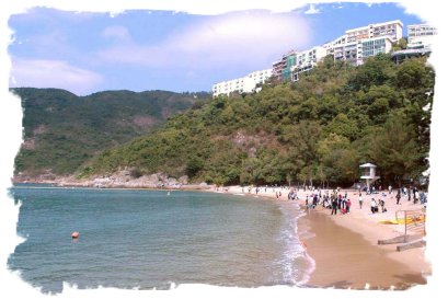
The picture below is taken from the government website, and they probably filled the beach to make it seem less empty (and come on! the sky wasn't that blue?!):
2. Central - Central Business District
Location: Midlevels in Central, North-west Hong Kong Island, Hong Kong
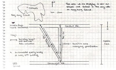
EDIT: The above diagram is slightly inaccurate. Thankfully, I checked with someone before I went into the exam room. It should show the same starting point and different stopping points.
We did an urban transect across Central, one of many CBD's (CBD = Central Business District) in Hong Kong. There, we examined land-use, building height, and environmental quality.
We concluded that Central is similar to the CBD represented by the Burgess model in that there are distinct land-use zones; but what's so unique about Hong Kong is that the residential buildings are very tall, due to the limit of space; hence the buildings start off very tall, then short in the old inner city (known as SoHo), then tall again.
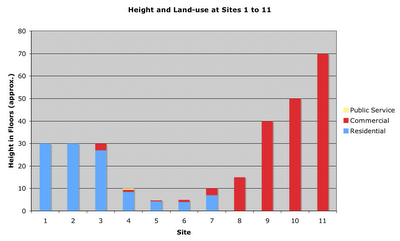
Photos I took are from the inner city (or transition zone) onwards; there's not much to see in the residential areas, unless you want to see my home...
Enjoy (from SoHo to Central):
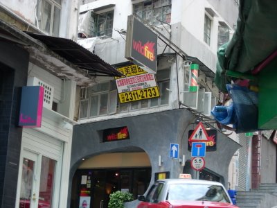
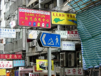
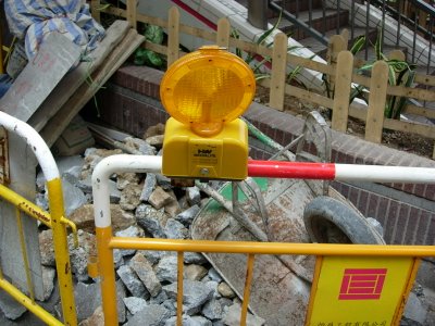
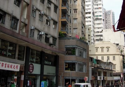

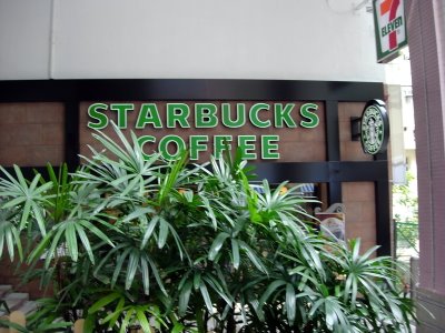
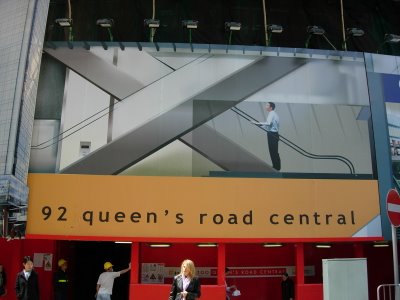
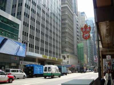
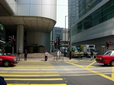
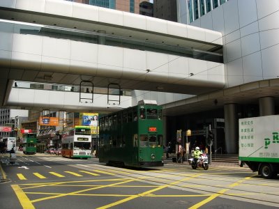
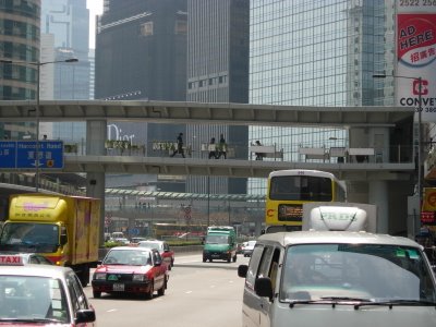
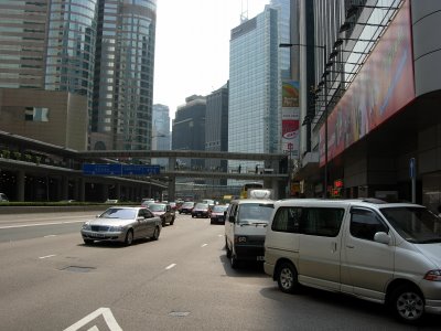
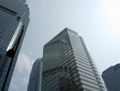
As you can see, the SoHo area is undergoing a lot of gentrification (the renewal of decaying inner cities). Foreign companies such as starbucks and wildfire, are invading these areas. Nevertheless, there are still signs of Hong Kong culture left, such as the old tram, old advertisement signs, and ancient buildings that will only be maintained.
I did not bother to label each photo, so feel free to ask about them.
Read Part 2 here.
Good luck to those who are doing AS Geography!
1. Chung Hom Kok Beach
Location: South of Hong Kong Island, Hong Kong

This is a small 150 m, public beach in a rich (suburban) district. When we went there, it was deserted (probably because it was a weekday), and the weather was really bad. But it was peaceful.
We went there to investigate whether longshore drift occurs on this beach. I don't want to bore you with the details, but in essence, our conclusion was that there was no conclusion...
I didn't take any photos here. However, I can summarise Chung Hom Kok as a tiny beach with many bands of beautiful shells.

The picture below is taken from the government website, and they probably filled the beach to make it seem less empty (and come on! the sky wasn't that blue?!):

2. Central - Central Business District
Location: Midlevels in Central, North-west Hong Kong Island, Hong Kong

EDIT: The above diagram is slightly inaccurate. Thankfully, I checked with someone before I went into the exam room. It should show the same starting point and different stopping points.
We did an urban transect across Central, one of many CBD's (CBD = Central Business District) in Hong Kong. There, we examined land-use, building height, and environmental quality.
We concluded that Central is similar to the CBD represented by the Burgess model in that there are distinct land-use zones; but what's so unique about Hong Kong is that the residential buildings are very tall, due to the limit of space; hence the buildings start off very tall, then short in the old inner city (known as SoHo), then tall again.

Photos I took are from the inner city (or transition zone) onwards; there's not much to see in the residential areas, unless you want to see my home...
Enjoy (from SoHo to Central):


As you can see, the SoHo area is undergoing a lot of gentrification (the renewal of decaying inner cities). Foreign companies such as starbucks and wildfire, are invading these areas. Nevertheless, there are still signs of Hong Kong culture left, such as the old tram, old advertisement signs, and ancient buildings that will only be maintained.
I did not bother to label each photo, so feel free to ask about them.
Read Part 2 here.
Good luck to those who are doing AS Geography!
1 Comments:
HI, SO NICE THE PICTURES!! VERY COOL YOUR BLOG.
TAKE CARE !!
AND HERE MY COMMENTS, I SAW U IN NEO. BYE!!
Post a Comment
<< Home